Google Maps Platformの Maps Static APIによる地図画像の取得方法をご紹介します。
Maps Static APIは Googleが提供する Google Maps Platformの RESTサービスです。指定された URLにアクセスすると地図画像を返します。
APIキーの取得
APIキーが必要です。APIキーの取得方法は APIキーの作成を参照してください。
APIの有効化
Maps Static APIを有効化する必要があります。
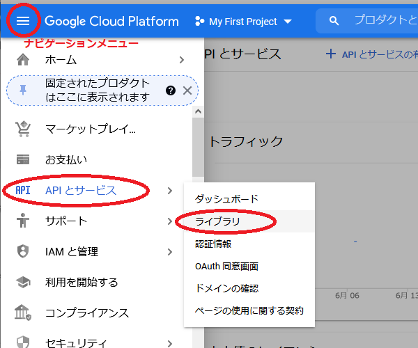
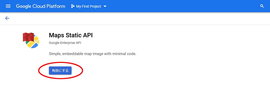
Google Cloud Platformにログインし、Google Cloud Platform 画面左上のナビゲーションメニューから「APIとサービス」、「ライブラリ」を選択します。
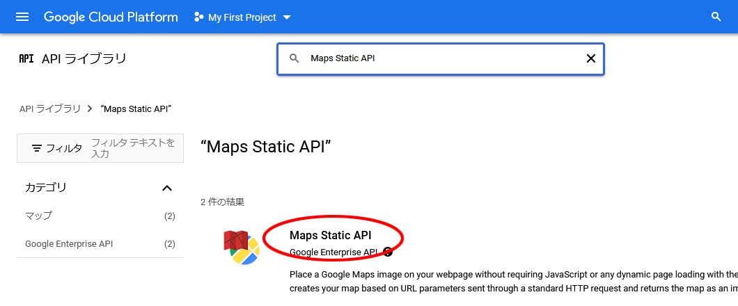
検索ボックスで”Maps Static API”を入力して検索します。

「Maps Static API」を選択します。
「有効にする」を選択します。これで Maps Static APIが使用可能になります。
APIのパラメータ
https://maps.googleapis.com/maps/api/staticmap?center={center}&format={format}&maptype={maptype}&key={key}&size={size}&zoom={zoom}パラメータの内容は以下のとおりです。
| center | 地図の中心位置(”緯度,軽度”) |
| format | 地図画像のフォーマット(gif、jpeg、png) デフォルトはpng |
| maptype | 地図の種類 satellite(航空写真)、roadmap(ロードイメージ)など |
| key | APIキー |
| size | 地図画像のサイズ(”横幅x縦幅”) |
| zoom | ズームレベル(0~21) |
パラメータの詳細についてはURL Parametersを参照してください。
実行サンプル
以下をブラウザの URL欄に入力して実行すると地図画像が表示されます。
※ APIキーを記述してください。
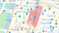
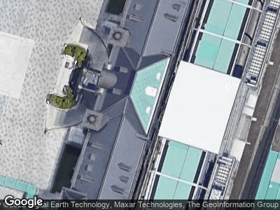
https://maps.googleapis.com/maps/api/staticmap?zoom=19&maptype=satellite¢er=35.68135257803937,139.76609230041504&size=400x300&key=APIキー
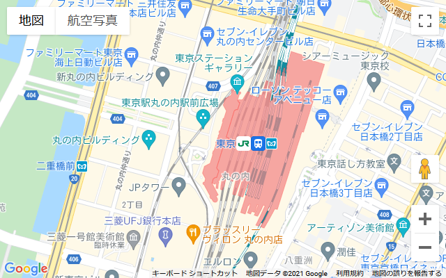
https://maps.googleapis.com/maps/api/staticmap?zoom=16&maptype=roadmap¢er=35.68135257803937,139.76609230041504&size=400x300&key=APIキー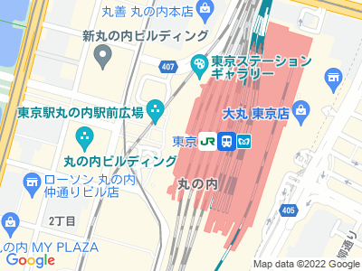
HTMLファイルのソースコードです。ブラウザで実行すると地図画像が表示されます。
※ APIキーを記述してください。
<!DOCTYPE html>
<head>
<meta charset="utf-8" />
</head>
<body>
<div><img src="https://maps.googleapis.com/maps/api/staticmap?zoom=19&maptype=satellite¢er=35.68135257803937,139.76609230041504&format=GIF&size=640x400&key=APIキー" style="width:640px; height:400px;">
</body>
</html>